
GPS stands for Global Positioning System which applies the satellites located in the space area in order to find the particular locations on the earth. This GPS technology is now utilized in the mobile devices, cars, and various other equipment to identify the current or specific locations based on the individual requirements. At the same time, the GPS enabled instrument usually helps everyone to discover the various unknown places. If you are using the handheld global positioning system (GPS) instruments, they usually will do any of your required tasks in an easier manner.
Gps For Fishing Activities:
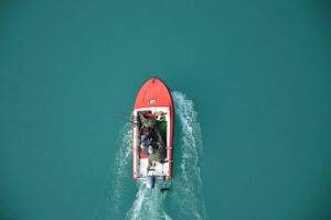
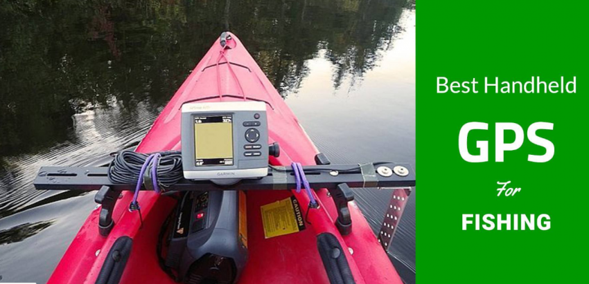
If you are a fisherman involving in the fishing activities on the daily basis, you can also utilize the best handheld gps for fishing or equipment for fishing. Such kinds of handheld GPS devices are usually very helpful to identify the exact fishing locations and also to return back to the seashore correctly. The following are the essential steps to easily and effectively make use of the handheld GPS for any of your fishing activities.
- Load the essential maps – In the first step, first of all, you should have to turn on the handheld GPS device. Then, you should check out the mp provider in the GPS receiver. You have to load the required maps into the GSP receiver’s memory. Some models of the handheld GPS equipment offer the nautical charts in the mapping providers.
- Connect to a computer – The handheld global position system (GPS) receivers usually offer the various methods to make a connection with the computer based on the specific model used. If your specific receiver model offers the USB connectivity option, it will give you the serial connections and transfers the data through the Topo USA. If other models make a connection through the serial ports, they will transfer the data through the proprietary software. From among the various brands of the handheld GPS receivers, you have to pick the best and top rated one which offers the most convenient option at all.
Other Significant Steps To Be Followed:
- Mark a starting point – While going to your fishing activities, it is highly essential to mark your fishing site where you are starting with the help of the GPS receiver. Similarly, this receiver will also provide you the strong signal to go on a right way to reach your fishing spot. The GPS receiver will give you the information about the current location accurately by acquiring the connections to the satellites.
- Using a zoom option – In the display of the GPS receiver, you can make use of the zoom option to an opposite scale. If you are using zoom in, it will give you the display with the on-screen scale of 80 to 160 feet. The fishermen should also have to consider the underwater terrain and also a level of the water surface. After starting our fishing journey on the sea water surface, the GPS receiver will continuously monitor and record the water surface level in order to record your positions and also the travel route.
Some Other Steps To Use The Handheld Gps Devices:
- Utilizing the breadcrumb feature – Most of the latest models of the handheld GPS receivers are generally including the special kind of the tracking option which is known as breadcrumbs that can able to record the fishermen movements. If you are turning on the breadcrumbs feature on, then the unit will begin receiving the data. This extraordinary feature will usually mark the route of the fishermen using the line which will allow everyone to reach your preferable spot in only the minimum time. This amazing feature usually helps you in returning to the precise spots later.
Under this particular feature, there is a need for the angler in order to set the recording distance in your fishing route. After that, the fisherman can set the markers on the pontoon boat within the range of usually 50 to 250 feet. This measurement will be done actually by considering the body size of the water.
If you are involving in the fishing activities on the sea water surface, then it is highly recommended using the measurement of 1/8 to 1 ¼ mile by considering the length of the fishing boat. Whenever you are fishing on the seashore or you are involving in the fly fishing activities, then the required breadcrumb will be within the range of 10 to 25 feet.
Label the waypoints:
During your fishing journey, the fisherman can mark your specific fishing spots. With the help of the handheld GPS receiver device, you can get several other options for the extraordinary features including a bookmark, favorite, waypoint and more. Similarly, most of the GPS receivers are also including some more significant features such as,
- Recording the date & time
- Selecting the icons
- Recording the latitude and longitude
- Recording the location name etc.
Moreover, some of the specialized models of the GPS receivers are including some other options in order to enter some of the significant comments. For this purpose, each and every fisherman should have to label the waypoints which are consistently using the icons.
Recording The Significant Information:
When you have completed your fishing task and you have decided to return to the shore, first of all, you should have to end the tracking task and then save the recorded data. The fishermen can able to store some of the significant information in your handheld GPS receiver device usually in the most systematic way.
For example, you can add the comments about the weather conditions, give a title to your trip, comments about the overall conditions, the temperature of the water, overall fishing results and any other useful information.
When it comes to the tracking feature, it can surely show you the route in order to identify any perfect fishing points. During your fishing activities with the handheld GPS receiver, everyone is highly necessary to carry enough amounts of spare batteries so you can travel the expected length of the trip.